Posts

Mount Apo and the Boulder Challenge

Mount Apo is the highest mountain in the Philippines. It has an altitude of 10,311 ft and ranked as 98Th prominent mountain in the world. It is located in Davao in Mindanao. This mountain is called as “master” or “Grandfather of Philippine Mountains”. The plan to climb Mount Apo was made last year. After the group found out that there was promotional flight to Davao (which cost less), the group grabbed the opportunity and we booked our flight five months earlier. After Mount Kinabalu climb wherein I was also part of the team, the group targeted Mount Apo. But, the plan to climb Mount Apo had a lot of preparations compared with Mount Kinabalu.

October 2008, training plan had been laid out. The plans were long distance walking, two mountain training climb (different mountain) and wall climbs. After the plan had been announced to us, I did understand that the group really made a big deal with Mount Apo. And because of that I realized that I should not take the climb so lightly.

The whole group took it seriously and because of that, we took all the trainings that had been planned. We all knew that if we will not force ourselves to attend these trainings, we will be the one who will suffer in the end because it will be very difficult to someone to climb Mount Apo without enough preparation.

November 15, 2008 Saturday was scheduled for fun walk and the fun walk last more than six hours for more than 30 kilometers walk. Then, November 22 2008 and January 13 2009 both were Saturdays were scheduled for wall climbs. And January 24-25 and February 7-8 both Saturday and Sunday for mountain training climbs. With that training plan in placed, we kept in our mind that Mount Apo climb will not be an easy task.

Since I am a rookie mountaineer (Mount Apo was my fourth climb), I prepared all my stuff. Like what I learned in mountaineering, I have to be self sustain and self equip. I created my personal checklist. I bought trekking pole because most of my previous climbs I used to borrow trekking pole with other mountaineers. I bought my personal first aid kit (just in case I need it or if someone from the group need it), first aid kit was required to all Mount Apo team, this also includes a mask because there is a sulfur pillars part in the mountain near the trail that we are going to pass. More than a week, I gathered all my things that I am going to bring during the climb. I bought another small backpack since I settled my own personal porter. I had many days of packing and unpacking my things. To be honest, at first I have a short checklist, then I keep on updating it because I do not want to miss anything that will jeopardize my climb. Mount Apo climb is not a fun climb, it is a major and difficult climb.

I think my introduction is enough.

Day 1 – Wednesday – Feb 25, 2009

NAIA Terminal 3

1AM meeting at NAIA (Ninoy Aquino International Airport) Terminal 3. Cebu Pacific flight is now stationed in Terminal 3. Terminal 3 is one of the elegant airport in the Philippines. Maybe because the terminal was still new. The terminal was exclusive on Philippine Airlines before, but
now, Cebu Pacific is currently stationed here. We met at early hours even though our flight to Davao is around 4AM. At 3 AM, we checked-in our backpacks and around 3:30 AM we were started getting on board. Before 4AM, we were all inside the plane. We arrived at Davao International Airport around 5:30 AM, flight was ahead on its schedule.


Davao City from the top (shot from the plane)


Davao International Airport and its premises

We have a contact group (which included tourism officer and mountaineering group) in Davao that will lead us to our Mount Apo climb adventure. This group picked us at the airport and led us to the jump off area. But before we left the airport, the group discussed the itinerary plan of the climb. Then, we hit the road. All of us are in the group are first time in Davao. After we found out that travel time will take some hours, each one of us took our own opportunity to sleep and rest before the climb start.


Some Views we saw while on our way to Baruring
(photos above with border are copyrighted by Jimmar Lagazo)


It took us 2.5 to 3 hours from the airport to jump-off area at Baruring. After arriving at Baruring we started to trek to see the Tudaya Falls before we start the formal climb. We descent 1.5 hours to Tudaya Falls and ascent same hour from the falls to Baruring.

Some of the views captured while on our way to Tudaya Falls
Pathway to Tudaya Falls (photo with border is copyrighted by Jimmar Lagazo)

Before we descent to Tudaya Falls, we were advised to just bring water and our lunch. But what happened in my case I still brought my backpack with all essentials such as food, first aid kit, hydration system, raincoat and other important things during the climb and the backpack is a little bit heavy. I was not able to transfer my other stuff to my bigger backpack because my porter already left and will trek directly to Tumpis where we will spent our first night. Because of my situation, I had some difficulty to descend the trail to Tudaya Falls and ascend from it. But it helps me to condition my self for the continuation of the climb. After we reached Tudaya Falls, my exhaustion seems to be gone immediately because Tudaya Falls is wonderful and amazing falls. We took our lunch at the ground near the falls. We had a great time in that place.


Tudaya Falls (photos above with border are copyrighted by Jimmar Lagazo)


Tudaya Falls

After we arrived at the top from Tudaya Falls, we waited for “Habal habal” as our transportation. “Habal habal” is a single motorcycle that will bring us back to Baruring. I already experienced riding a motorcycle, but the experienced I had for “Habal habal” was different this time and I knew that it was the same thing to the whole group. Imagine a single motorcycle that will able to ride four passengers including the driver. Well, one thing that I noticed, the motorcycle tires used seems to be intended for rough roads because the tires are bigger. The rides were both quite exciting and scary because there were part of roads that was incline and we were either going up or going down. One mistake of our driver will result of our own accident. But the great thing about it, the whole group rides the “Habal habal” and all were able to get back to Baruring safely.

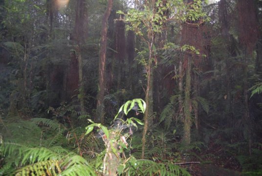
Next, we rested for a while at Baruring and the proper climb had been started. We trek the first part of the trail from Baruring to Tumpis. Before we started the trek, rain already started. If there is a rain, that means we expected that the trail will be muddy and slippery. The trail from Baruring to Tumpis were still easy because we pass the farm land area. We saw different kinds of vegetables along the way. To be honest, I still appreciated the scenery that I saw, well green place is beautiful to me such as farm. From Baruring, the trek lasted from 3 to 4 hours. After we arrived at Tumpis, we pitched our tent and spent our first night at Tumpis. We never worried for water source since there is small housing community in that place.

viewable area of Mount Apo (peak covered by fog)

Day 2 – Thursday – Feb 26, 2009

a morning view that greets me before we start the second day trek

We woke up around 5AM, prepared ourselves and started the second day trek at past 6AM. The plan to accomplish that day is to reach Camp 1 and Camp 2 inside the Mount Apo. From Tumpis to Camp 1, it took us 4 to 5 hours, from Camp 1 to Camp 2, 1 hour. We had our lunch at Camp 2. After Camp 2, the Boulder wherein the climb will last within 4 hours.

Base of the Mountain (photos above copyrighted by Sir Vincent)

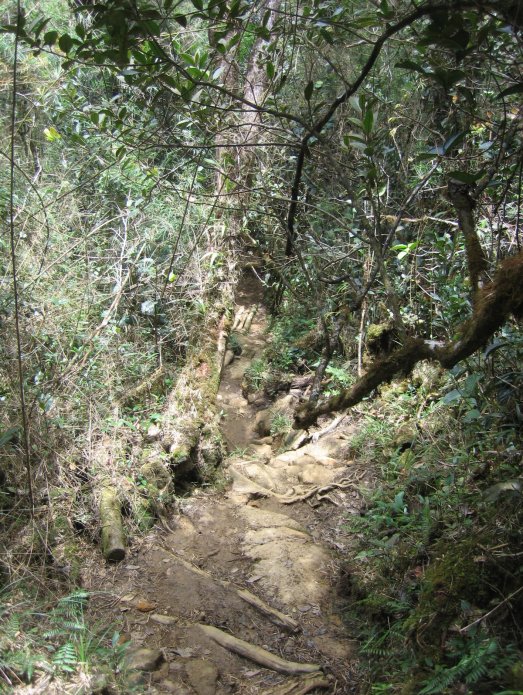
From Tumpis to Camp 1, we passed grassland area until we reached the base of Mount Apo. Then the ascent started. Few minutes ascending the Mount Apo, we found ourselves in a narrow pathway. At first I never used my gloves, but after the incident that I was wounded because of some thorns in the plants beside the trail, I forced to used it. Since it rained, the path had water and some path are muddy. I was never surprised anymore since it’s really raining in the mountain. And muddy trail is not astonishing anymore. We continue the journey in the mountain. Mount Apo does not have a well-built strong groove to hike. This means that, the pathway is just simply the footprints of the earlier mountaineer. No stairs unlike in Mount Kinabalu wherein the trail had already built to be friendly trail. Mount Apo does not have that case. And since it rained the day before the trek and also rained during the climb, expected that the hike will be worst because the ground will be filthy and unsafe and because of that, I had been very careful. I remember that because of sloppy ground, I already expected that my shoes will be covered by water and mud. There were times, that even I do not want to glide, but I had to glide because its safer to glide and sometime because I have no choice. It was a relief that we had reached Camp 1. then we rested for 15 to 20 minutes, then we continue the exploration of the mountain until we reached Camp 2. The rain poured us while we were having our lunch. I thought we can rest there and probably build our tent, but the plan changed. The climb continued from Camp 2 to Boulder. After lunch, we continue the trek.

Inside the mountain (photos above copyrighted by Sir Vincent)

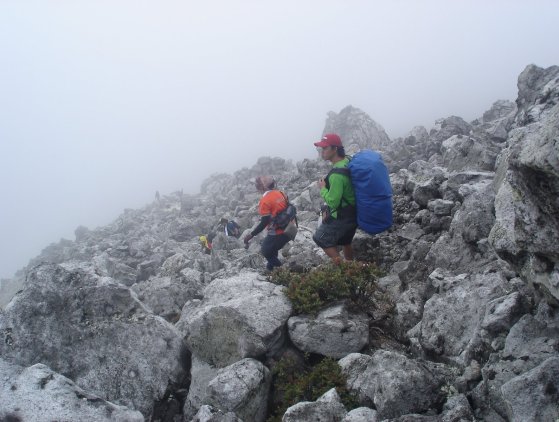
Boulder is the most difficult part of the mountain (aside from the muddy part trail). Boulder is rocky part that we need to pass. From Camp 2, we passed the dried river of the mountain, the river has lots of irregular rocks, which for me the start of the boulder challenge. Different kinds of skills to be able to pass small and big rocks. Sometimes, I have to cross one rock from another rock. Then, I have to walk to small pathway area to be able to continue the climb. This was just the river part. When, I found out that the river is not the boulder yet, there was part of me that thinking “if this is not the boulder part, then I must be expecting worst”.

The river pathway had been ended but the boulder part start off. And we saw from there the sulfur pillars. Sulfur pillars is near at the trail that we are going to stroll. And the issue will be the smell of the sulfur, that is really stinky and will cause us to vomit or difficult to breath. That was the time, I took out my mask to help me to survive trekking the path near the sulfur pillars.

While climbing the boulder part, I realized to myself, how will I able to pass this rocky part of the mountain. There was a part of me that asking myself, “Will I survive on this mountain?” And then, I just saw my self struggling to climb the rocks. I thought at first that I will never able to pass the boulder, but the wall climb training that we had in the group and my gloves really helped me to be able to pass the boulder. Boulder part has more rocks, some rocks are bigger and taller than me and will question myself “How will I be able to climb this one?”, then I have to be clever and think a way to do that. There was part of boulder wherein there was slant area, then, while climbing that part, I realized that I was near top, and I do not want to look down. I have to be really careful because the area of footprint is just enough for one step at a time and I moved myself in side way position because if not, I might fall. After passing this part, I was ecstatic because I made it to the end part of the boulder and I passed the boulder challenge.

end of dried river and boulder start off


Boulder Photos (photos with border are copyrighted by Jimmar Lagazo)

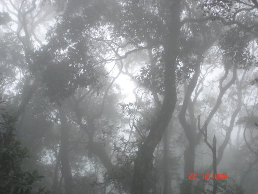
After reaching the area before 87 Degree (87 Degree is the trail that the team will take to be able to reach Mount Apo Summit), the group built the camp and we spent our night there. The night was so cold. And I cannot stay outside the tent during that time, my buddy and I spent most of the time inside the tent during that night. We just let ourselves out to have our dinner. Before I sleep, I had my complete gear for the cold condition of the mountain such as thermal wear, gloves, sleeping bag and socks. I did survive that night in the mountain.

Day 3 – Friday – Feb 27, 2009

The group planned to wake-up at 5AM so that we will be able to witness the sunrise at the Summit of Mount Apo. I woke-up before 5AM. Then I prepared myself. That time, it still a little bit dark and we started the trek with our headlamp. The group had a short walked from the camp to 87 degree. I saw 87 degree and the trail is a rock face. It was called 87 degree because of the measurement of the slope. Then, I started to climb the 87 degree. While climbing, I can hear the beat of my heart. I had mixed emotions, I felt scared, nervous, but determined to complete my climb. My pace was a little bit slower compared with other mountaineers in the group. I remember, there was a part of the 87 degree wherein I was almost at the top near in the crater lake of the mountain, I was trying to avoid to look down because I might feel something and I might fall. I tried to step forward many times but I was scared. Then, I told to myself, “you’re almost there, why are you going to stop now ?”. I looked around while I was struggling with myself. Then, I found the beautiful view of the ground, at that point I was inspired and told myself “you can do it”. Then, I was able to step forward to that difficult part of 87 degree and I reached the end of it.

Pathway to 87 degree
87 degree – trail to Summit
Crater Lake
Crater Lake
Crater Lake


Crater Lake photos (photos with border are copyrighted by Jimmar Lagazo)

View from 87 degree (this is another version of the view from the ground of Mount Apo)
(photos with border are copyrighted by Jimmar Lagazo)
(photo above copyrighted by Sir Vincent)
this is the scenic view that made me inspire to continue to climb 87 degree

After reaching the end of the 87 degree, I saw the crater lake. I was amazed. For me the small crater lake was incredible, the water was so clear. At the middle of the crater lake, there was a pressure part because there are some bubbles on it. Well Mount Apo is known as one of the stratovolacano but the last eruption was unknown.

Then, after the crater lake, I continued the climb up to the summit wherein the trail was easier compared with 87 degree.

Finally, I reached the Summit of Mount Apo at past 6AM, most of my team when I reached it, were already taking their photos. Well I did the same thing, because it is a moment in our life, reaching the Summit of the Highest Mountain in the Philippines. It so cold at the top. When I reached the top, all I can see are clouds and white sky. We waited to have some clearing. And I saw the other peak of the mountain from the other side. I saw crater lake from the summit. We saw the rising sun which still covered by the clouds. We saw sea of clouds.

Sunrise covered by clouds at the Mount Apo Summit

It felt so great that I achieved another thing in my life, I was able to reach the summit of Mount Apo. I thought this was just a dream but it became a reality. We stayed at the summit for a few minutes but then we decided to descend because of the strong and cold wind.

If ascending in 87 degree was challenging, the same thing of descending it. All I was thinking is to be careful while doing it, because I want to go back alive. After less than an hour, we reached the ground. I was relieved and thankful that I made it, I passed 87 degree.

Some of the team went to the other peak, but some decided to go back to the camp and I am one of the person who went back to the camp. Next, we had our breakfast. Then, I prepared all my stuff for the next thing, which is to descend the mountain. Descending mountain started at around 9:30 AM.

Same experience I had while climbing the boulder part of the mountain. But this time, its more difficult because the wind direction is against us and I can smell the sulfur from the bottom part of the boulder. I can also feel the heat of the sulfur excrete from the ground. My pace was slower. And that time, I totally able to see the whole boulder part of the mountain which surprised me and even myself cannot believe that I was able to pass it. After reaching the end of the boulder I was thankful again. Because I did survived in boulder. The trek lasted almost 4 hours.


Sulfur Pillar
Sulfur Pillars
Sulfur Pillars
Sulfur Pillars
Sulfur Pillars
Sulfur Pillars


Boulder photos captured during descent

Then, we trekked the dried river again. Our trek was traditional and not a traverse. This means that, the trail we took to reached the summit was the same trail to reach the ground. After reaching the Camp 2, the thing that I deal with were muddy trail and slippery pathway. Another hour passed, I reached Camp 1. After Camp 1, next was Tumpis. The group spent our night again at Tumpis. I reached Tumpis at almost 6PM that day.

While on my way and probably at the half of the trail from Camp 1 to Tumpis, rain started. This adds up to the difficulty to go down to the ground. It was so muddy, my shoes took shower with the rain, dip into the mud, covered my whole feet. Then, I have to control myself not to drift away but there were situation that I cannot helped myself. I really have to skate into the mud. There are trails that I have to crawl because there were huge trees that fall into the trail. Sometimes, I have to depend on trees, on its trunks, or other parts of the plants that I can hold on for a while to have a safe slides. From Camp 1 to Tumpis, I took it almost 4 hours, unlike with my other co-mountaineers, they just let their selves go with the flow and do not matter anymore if how many times they will fall, glide, slide into the mud. I was thankful again because I reached Tumpis and I was safe.

When I reached Tumpis, I was really tired. All my clothes that I was wearing while descending the mountain were wet. And I felt so cold. I know that from Tumpis to Baruring, the trail will be easier. But the problem was my feet. My toe nails were aching. And this was the reason why my pace from Camp 1 to Tumpis was so slow. After the whole team reached Tumpis and all were safe, the whole group were happy and enjoying. The group accomplished Mount Apo with safety. That night, most of the men in the group had fun, they celebrated and drink wine. The ambiance and the spirit that night was full of joy, joy of accomplishment. Each of us were proud to ourselves. I felt the same thing in my heart.

Day 4 – Saturday – Feb 28, 2009

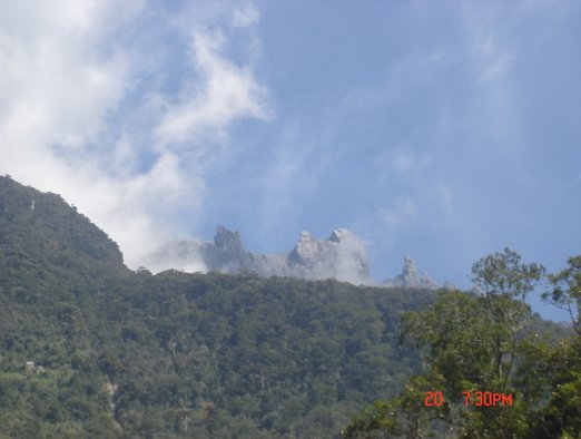
We woke up around 6 AM and went down from Tumpis at 7AM. We arrived at Baruring at past 10 AM. From Baruring we saw Mount Apo, but this time the sky was clear and no clouds covering the peak of the mountain. We spent our time at Baruring for couple of picture-taking. And all of us were excited to see Davao City and have some fun after completing our Mount Apo adventure.


Mount Apo from Baruring (at last we saw the peak due to clearing)

After reaching Baruring and after I saw Mount Apo from a far, I questioned myself like this “Did I really climbed that mountain? I can’t believed that I did. I can’t believed that the climb was over”. During that time, I thought that all experiences that I had to climb that mountain were just a dream and not for real. Well, I think, Mount Apo climb is the most dangerous climb that I had so far. For me, the climb was harder than Mount Kinabalu. It is somewhat extreme for me. And I am glad that I was back on my feet and I was safe.

I was safe and I was able to write this experience here.

Mount Cristobal and the averse climb

Mount Cristobal is one of the mountain that commonly climb by mountaineers. Every serious mountaineer in the Philippines climb this mountain and this will not be excluded in their list as one of the challenging mountain. You cannot called yourself as mountaineer if you have not climb Mount Cristobal (this is what I used to hear from other mountaineers in my group and what I used to read from internet from other mountaineers in my country).

After I confirmed that Mount Cristobal will be one of the mountain for our training climb before Mount Apo (the highest mountain in the Philippines), I was kind of hesitant because everything I heard about this mountain were not good, most of my team members in the mountaineering group where I belong told me their last experienced in this mountain was unpleasant.Based from the last and worst thing I heard about this mountain, I become afraid to try to climb this one. But I realized that I have to face it if I wanted to climb Mount Apo.The big day come and I told myself to focus on the beauty of the nature that I been wanting to see on this mountain.

Mount Cristobal is located at Dolores, Quezon Philippines. It is located near in Mount Banahaw (one of the famous mountain in the Philippines and used to climb by mountaineers too).

The group assembled at 4AM at 7/11 store in Buendia near in bus station where we will ride a bus that will carry us to San Pablo, Quezon.

While on our way to jump off site (from San Pablo to Dolores Quezon)

After we arrived in San Pablo around 6:45 AM, we rented a jeep that will drive us to Dolores, Quezon (to our jump off location) where we will start the climb.

We finally arrived in the jump off place. And we observed that it will rain soon because there are raindrops falling already.

jump off site

First part we passed the cemented trail with moss on it. To visualize it, you can imagine that if you walked on the cemented area with moss you will probably be very careful because the trail is slippery and one mistake leads to fall and accident. That was what I felt, because of that, I passed this trail with slow pace for safety. And I observed the other team member did the same thing what I did.

Mount Cristobal view from jump off area
side view of Mount Cristobal
view captured while starting to trek the trail to Mount Cristobal

Mount Cristobal trail

After an hour climb, our lead decided to stop and picked the place where we can build our camp to spend our night. We rested for an hour for building our tent and for our lunch. At 11 AM, we climb again. During the climb, my heart rate go faster and faster due to the fact that I am very near to the part of the mountain that will challenge myself physically and mentally. I set to myself the most difficult part of the climb in this mountain. I remember what I heard, there is a rocky part of the mountain that I will pass wherein I will walk on the roots and I need to hug the huge rock with plants on it with thorns. And if I will not do it, I will fall in the cliff. This is the description I stuck on my mind that I am hoping that I will be able to pass.

The climb goes on, I enjoyed the trail while trekking the mountain. It is covered by trees. One thing that I observed, the stairs are made of soil and roots. If roots gone, I am not sure if the stair trail will stay for long and I think no one will able to stand on it and able to reach the top of the mountain. I am very thankful to those big roots.

Inside the mountain

After more than an hour of climbing we are passing a trail wherein it so tiny space for walking because the side of it are cliff but the bottom of it are not viewable due to plants at the side is covering it. Then, I just found myself, walking to the limited space and holding the roots. Next are the big rocks that I have to hold tight because if I will not do it I may fall on the cliff. After passing that part, I heard that it was the rocks that I been thinking about except there are no thorns on it. I prepare my gloves for that rock, but I haven’t used it because I never saw thorns on it. But one thing that I remembered, my heart rate was really fast and I took it slowly and my focus are on it. I said to myself, I should not take a chance to make mistake. I am very thankful for the roots that I able to hold and while writing this, I am wondering, how long does those roots will be able to stand on its strength if mountaineers used to get hold on it just to be able to pass that difficult trail part of that mountain.

Mount Cristobal was the 3rd mountain that I climbed (as real mountaineer). And this is the mountain that let me experienced the combination of simple walking on the trail up to climbing a rock (with moss most of the time) and I have to depend on the trees beside the trail because I may fall because of wet and slippery rocks. Then, we reached the place where they call it crater 1 (someone just mentioned to me that there is crater 2). After reaching the crater 1, the group stopped and talked for a while. The group decided to continue the climb up to the ridge or the summit of the mountain. One thing that the group was not sure, if there are other group who climb up to the summit that had created the trail, because if none, that means we have to create a trail to be able to reached the summit. But the good thing, the trail does still exist.

While ascending the mountain, I am thankful I bought a hat that protects me from towering grass. The trail is narrow and the grass leaves are slapping our face if we are not able to hold it. After we reached the summit of the mountain I can feel the blow of the wind and it was forceful (which expected because we are at the top of the mountain). At first, we cannot see the view below because of the clouds, but after clouds got cleared, we were able to see views that for me are awesome to glimpse.


View from the summit

In total experienced, I love Mount Cristobal, not because of the view I found at the top, but the different experience I had while climbing this mountain. I can say the climb was not easy for me, but I won against myself because I never let my fear win over me.


Views while in Mount Cristobal – at the camp site

Mount Kinabalu – A Wonderful Challenge

I just like to share my first and formal experience of being mountaineer. I remember when I was in college, there was a mountaineering club in the university that I wanted to join in, but when I tried to talk to my college friends and classmates, they were not into it and not interested in hiking a mountain. Because of the situation, I thought I am the only one who likes it, because of that I never tried it out. Time passed, I graduated in college, now I am working and after six years, I met a good friend who is an active mountaineer.

He mentioned to me the plan that he and his group will be going to Mount Kinabalu in Sabah, Malaysia on September 2008. After I heard it, I told him, “Can I join the hike?” And he said “Sure, but Mount Kinabalu has an altitude of more than 4000 meters above sea level. Do you think you can do it?” And I said, “I can try to  and I will prepare for it”. That was the start for me to go for the things that I really wanted to do from the first place. Maybe before I was not pushed enough to go for what I like to do and now that I have a chance, I am grabbing my opportunity to do it.Before this major climb, I reminisced my last climb during my last year in college. We hiked Mount Santo Tomas in Baguio and I knew in my heart that I enjoyed the hike. I remember that the trail we used to reach the peak of the mountain was pretty straight forward and there were not so much hurdles to hike the mountain. All I remembered and I cannot forget was before we were able to reach the peak, there were raindrops falling and the wind gets stronger that I almost think wind can blown us away. But I knew in myself that I like hiking and the experience was a good adventure for me.Now I am going to tell my climb experiences in Mount Kinabalu and I am telling you, it is not been easy for me.Mount Kinabalu is the 20th world-famous mountain based on height and its beauty. Is it the highest mountain in South East Asia. It is located in Sabah, North Borneo Malaysia and the climb was held last Sept 21 to 24 2008.Day 1 – September 21 (Saturday)

The schedule flight to Kota Kinabalu from Clark (or Macapagal) International Airport is 4:45 PM. The group met at 8AM in Jollibee at St. Francis Square near in SM Mega Mall in Pasig since the bus going to Clark Airport is stationed here. From there, we traveled from Pasig to Clark from 9AM to 11 AM. Since our flight will be later in the afternoon, we used our waiting time inside the mall and we had our lunch there. While looking around the mall, I remembered that I have to buy a raincoat. While looking for a raincoat I remembered that I forgot to bring my head lamp that I will be needed for night trek.

Around 2PM, we went back to the airport. While waiting in the line to enter at the airport entrance, I prepared my passport and e-ticket, to my surprise I printed a wrong e-ticket (this made me nervous). When its my turn to present my passport and e-ticket to the entrance officer, I told him that I printed the wrong e-ticket and I asked him, “where I can request to print my e-ticket?”, the officer led me to the right direction. During this time, I thought I will not be able to travel and not able to go to Malaysia. I am glad that the office where I had my flight booking is open and they were able to print it. After I got my e-ticket, that’s the only time I was relieved. My mountaineering group inside the airport is waiting for me and they are all smiling at me after they saw me (I felt that they also relieved that I had my e-ticket and I will be able to go with them with this challenging adventure).

While writing this blog I would like to note that two things I learned on that day. First, list down all the items that I have to bring on the climb and second counter check many times the backpack if all my stuff are already on it.

Clark or Macapagal International Airport
View from my window after I woke up from a nap during the travel
from Clark Pampanga to Kota Kinabalu
Kota Kinabalu from the plane
Kota Kinabalu International Airport

Around 3PM in the afternoon we were inside the waiting area of the airport. Around 4 PM, our plane arrived. Almost 5PM, plane took off and we landed in Kota Kinabalu at past 6PM.

After we arrived in Kota Kinabalu, the group discussed the lodging or hotel that we can sleep in for the night before the climb on Sunday morning. Lodge was not really a big issue because after we found a cab that will drive us to the city center of Kota Kinabalu, it’s fairly easy to find lodging for backpackers. After we found the lodging, the group just had dinner and all were setup to sleep for the next big day.

Day 2 – September 22 (Sunday)

We woke up at 5AM. The group prepared, then headed to the cab station that will drive us to the jump off area of Mount Kinabalu. We rented two taxi cab for the whole group and we started to travel at 7AM. While on our way to our destination, we had a chance to see the beauty of Kota (“Kota” means city) Kinabalu, we also stop in Mount Kinabalu lookout viewpoint where we experienced to see the beauty of the mountain from a far. All of us are amazed on what we saw. And I myself realized and asked myself, “Is this the mountain that I am going to climb? Can I really climb that mountain?” I cannot believe myself either and along the way, I am fighting and convincing myself that I can do it.

Mount Kinabalu from a far (photo copyrighted by Jimmar Lagazo)
Mount Kinabalu View while we are on the road

Mount Kinabalu from lookout view-point (photo copyrighted by Jimmar Lagazo)

Mount Kinabalu peak from lookout view-point (photo copyrighted by Jimmar Lagazo)

Mount Kinabalu from lookout view-point

Next, we pickup our three guides for our trek. Then, we drove to the jump off station. Before we start our climb proper, one of our guide made an orientation and explained the trail path that our group will take. Mount Kinabalu has two trail; Misilau and Timpohon trail. The group plan is to ascend the mountain by Misilau trail and descend it through Timpohon trail. During the orientation, our guide gave us our packed lunch which was part of our reservation paid in Laban Rata, a hotel near at the peak of the mountain where we are going to stay for the night before trekking the final trail to the summit of Mount Kinabalu.

Views while on our way to jump off area

Mount Kinabalu (photo copyrighted by Jimmar Lagazo)

Entrance to Kinabalu Park (photo copyrighted by Jimmar Lagazo)

Misilau Trail jump off site


Trails to Mount Kinabalu Peak

We started our climb at almost 11 AM. The journey had begun. While climbing the mountain, I had a lot of experiences. The great thing about it was seeing the beauty inside and outside the mountain. Mount Kinabalu is a protected mountain, and most of our trails were covered with towering trees that was why we were not bothered by the sun rays.


Some trail pictures (photos above copyrighted by Jimmar Lagazo)
View while trekking the mountain (photo copyrighted by Jimmar Lagazo)
Trail View (photo copyrighted by Susan Reyes)

During the trail, we experienced rain from some point of the mountain. And I cannot forget the part wherein its raining and the trail was some kind of muddy, then there were lots of irregular stairs that we need to take. At that point, I hated stairs (but I have to deal with the stairs whether I like it or not). During that time, wind was powerful and I felt the cold because my jacket was wet due to rain even I used my raincoat. After climbing of more than seven to eight hours, I had some difficulty to climb the mountain. But I know I can still climb. But I brought a lot of water which adds to the weight of my backpack. Our team lead in the climb, asked me. “Can you still carry your backpack?” And I said, “Its ok, I think I can”, but what he did was asked one of the guide to get my backpack and port it from there to hotel. I did not object maybe because I am tired too. And I can see that it’s also the same thing felt of my group about me. Another three hours passed before we reached the hotel. To be honest, I am the last person to arrived the hotel. All of my group member were asking me if I was ok and I said to them that I was fine. For me that was both wonderful and difficult climb that I had.


some of the views to see while climbing the mountain


one of the view that we found while trekking the mountain


amazing views that we passed while on the small bridge


The hanging bridge

View from the hanging bridge
(photos above copyrighted by Jimmar Lagazo)

Laban Rata hotel for what I know is located between 3200 to 3300 meter above sea level (masl). I never realized that I was able to climb more than 3000 masl. When I arrived at hotel, that was almost 10PM. And the next climb proper to the peak of the mountain will start around 2:30 AM (I am thinking, how many hours of rest before that time).


Laban Rata Hotel
Laban Rata Hotel – where we stayed before trekking the final summit of Mount Kinabalu
(photos above copyrighted by Jimmar Lagazo)

During the dinner, the group discussed that we were all surprised of long hours of trek and all of us chanted that was really tiring and difficult climb. I can see in my team, that all of us had a great deal with Mount Kinabalu. We were thirteen in the group and only three people decided to climb up to the peak of the mountain that night. I myself, decided not to force to go to the peak. I am really tired and I know I can if I had enough time to rest, but four hours was not enough for me to have another climb. After the dinner, the group went to the room then went to bed with a decision that most of us are not going to climb up to the summit.

Day 3 – September 23 (Monday)

Around 1:30 AM, I just felt the team lead of the group woke up and tried to ask the sleeping group, who will be the other to join him to go for the summit. And then, one by one were starting to moved around and woke up. And I heard them that they were decided to go. Out of 13, 10 decided to go. And I am not one of them. Then, there was a part of me telling me to try. I can go back to the hotel if I can’t really make it.

The group that will go for final ascent left the hotel around 2:30 to 3AM in the morning. Then, I decided to follow, after that, when I got out I felt the cold wind in my body and in my face. And tried to follow the trail together with other two co-mountaineers in the group. Then, I brought my oxygen canister, because I know that air in the summit will be thinner and will be difficult for me to breathe. Then, I started to climb again, but few meters from the hotel, my oxygen canister fell and I had to look for it. Then, I become skeptical if I will go further or not. I think twice and got confused. After I saw my oxygen canister from the ground I tried to continue the climb, few minutes I felt difficulty in breathing and I realized that I have to stop. I have to stop trying and go with others. I thought that I am so much tired and I have more than 6 kilometers to descend (I need to reserved that energy). I went back to the hotel and on my way back, I told the couple mountaineers (they decided to go to the summit too) but when they saw me, they went back to the hotel with me and decided not to go further too.

At the room, there was a part of me that I wish I can go to the summit. But, I know my self limit. And be realistic that when I got outside, I felt that its hard to breathe. We slept few hours and woke up after hearing that the group arrived from the summit. 5 out of 10 (decided to go to the summit) were able to reached the summit. Some reached the other peak of the mountain. I congratulated all of them, because I know that at least some of the group were able to finish up to the summit of the mountain. We had our breakfast and started to descend the mountain.


Inside the mountain while descending it (there was fog)

Carson Falls in Timpohon trail

We were able to catch up the lunch (which serves as our lunch/dinner) that day. And then rest for a while before going back to the city. Our guides gave us our climb certificate. My certificate indicated that I was completed the 3500 masl climb and for me that was really awesome. I know that Mount Kinabalu highest peak is 4095 masl. I am still proud of myself that I able to climb a mountain with that altitude. For me it was an achievement.

Mount Kinabalu is a beautiful mountain for me. It has a very friendly trail especially the Timpohon trail. While we were on our way descending the mountain, we saw a lot of tourist taking that trail to climb the mountain. Unlike Misilau trail, we just saw two which tried to descend the mountain.

Mount Kinabalu has amazing peak and the shape of the peak is really fantastic. One of the mountaineers in our group able to capture lots of pictures at the summit after reaching it. And after I saw them, the view were really panoramic. How I wish I was able to reach the summit too. But I can try to climb the mountain again next time if there will be another opportunity.

For a beginner like me my team recognized and told me that I was pretty good during the climb.

Because of all experiences I had in this mountain, I will never forget “Mount Kinabalu”.

Remembering Banff – Part 2

If you read my second blog about Banff, now I am going to cite the story about my third and last day tour in Banff. I had been so excited for the past two days of my tour in Banff, but the excitement that I have still not perished in my last day tour. The main reason why I am still excited, I am going to Columbia Icefield in Jasper.

Ice and snow are the things that are not familiar to me because I am living in a tropical country. And I have been dreaming to experience snow or walk in ice.

Before we went to Columbia Icefield, there were other interesting places we visit. While traveling along Icefield Parkway (or Highway 93) – a highway road that you can see both Banff and Jasper National Park, I am stunned because of the rocky mountains in each side of the road. Because of the scenic view I saw, I became a rocky mountain lover. While inside the tourist bus, I took a lot of pictures of rocky mountains and I can say that I shot my digital camera to all mountains that my eyes can see. I cannot stop myself to admire those rocky mountains.

rocky mountains from Icefield Parkway

While on the road, we saw Crowfoot Glacier and I had been lucky because I captured a picture of it while inside the bus. Then, we stop over in Jimmy’s place. Before, I thought that was the real name of the lodge until I found out that it is the famous Num-Ti-Jah Lodge. in Icefield Parkway. The lodge was founded by Jimmy Simpson and it is located near in beautiful Bow Lake where you can see both Bow Glacier and Crowfoot Mountain. We had our hot chocolate inside the Num-Ti-Jah lodge and because of it we had a chance to view some of the arts and crafts created by Jimmy Simpson. We were also informed that the lodge was built by Jimmy with his own bare hands (based on history – he has no knowledge about building house and architecture) and that was really amazing. I also found out that the lodge will be probably become part of Canadian National Historic Site.

Crowfoot Glacier
Icy Bow Lake
Crowfoot Mountain
Bow Glacier
One of the rocky mountain
Num-Ti-Jah Lodge
Inside the Num-Ti-Jah Lodge

After Num-Ti-Jah lodge, we traveled again. We stop at the side of the road and after I got myself out in the bus I was surprised because of panoramic view of Mount Chepren and Waterfowl Lake. Mount Chepren has its own distinct shapes compared to other rocky mountains and the Waterfowl Lake adds beauty to the mountain. Waterfowl lake is amazing too, I saw most part of it as icy water (same like Lake Louise and Moraine Lake).

Mount Chepren and Waterfowl Lake from Icefield Parkway
Waterfowl Lake (with rocky mountains)

The next place we stop was where we had our lunch – the place was near in Saskatchewan River Crossing. We had our table where we were freely enjoyed the great view of North Saskatchewan River. I am wondering why it was called Saskatchewan River Crossing and I just found out from our guide that this great Canadian Heritage River is crossing other river such as Howse River and Mistaya River (but I never got a chance to see the other two rivers). While writing this blog, I remembered North Saskatchewan River is also the same river that I had chance to cruise in Edmonton (what a great surprise!!!).

North Saskatchewan River

After lunch we went back to the bus and started to travel again. And the moment I have been waiting for had arrived, we were in Columbia Icefield Centre. After the bus came into halt, I picked my winter jacket, my gloves and my bonnet hat, then I went outside the bus and of course I looked around and I took pictures as much as I can. We waited for our tourist guide to park our minibus. Then, he led us to the bus driver that will send us to the area where we can transfer and ride an ice explorer. Ice explorer is big wheel vehicle that was made for ice exploration at the top of the glacier. When I saw the ice explorer or the snow coach vehicle, I am surprised because it is so huge, I remember that the wheel is almost the same of my height. And another surprise is that the vehicle can carry a lot of people. After I got myself onboard in the ice explorer, I got my digital cam on and I both took videos and pictures while on our way to the top of Athabasca Glacier. Ice exploration was one of the great memories I had in Jasper and Banff National Park. I am not fully aware how is the feeling while walking at the top of the glacier. Speaking of Athabasca Glacier, I have information that this is the friendliest glacier that people can take to be able to go to the Columbia Icefield. Some glaciers are meant for the adventure extremist but Athabasca Glacier are meant for all type of people. Few minutes passed, we arrived in the top of Athabasca Glacier. The feeling was so great after I got out the ice explorer. There are lots of people at the top of the glacier . I saw different kind of people such as children, young, adult and old ones, all were enjoying the scenery. And my dream came into reality, I was able to walk in the ice that really thrilled me. And I am so glad because of the thought that I was near in the middle of the Columbia Icefield through Althasbasca Glacier. Walking in the icefield was exciting, fun and scary but I had a great time. Some people got fall in the icefield ground because some part of it is slippery due to solid ice, but even that was the case, people were all enjoying. I chose the part of the icefield with snow, then I tried to picked some snow and I made snow ball. After I did that I felt that my hands got numb (because of it, now I understand the feeling in a cold place like glacier). The experience was worthy and I enjoyed Columbia Icefield ice exploration.

Athabasca Glacier in Columbia Icefield
ice explorer or snow coach
Views in the glacier icefield
old snow mobile

North Saskatchewan River – Edmonton (Part 5)

I booked an Edmonton Queen Riverboat cruise. My main reason for doing it was to experience North Saskatchewan river. From the time I arrived in Edmonton, I was fascinated already by this river.

I took a cab from Legislature Building to Edmonton Queen Riverboat center at 98Th avenue. I gave my reservation booking to one of the crew and they gave me my entrance and dinner ticket. But on my way to the rafters landing area where I am going to ride the boat, I lost my ticket somewhere. So, I have to go back and look for my ticket or else, I will not be admitted to the entrance and I will not have my dinner (this situation made me felt bad). I went back to the center where I get my ticket. On my way, to the center, other tourist that coming approached me and asked if I lost my ticket, and I told them that I was. After saying that, they showed my ticket and gave it to me. Then, I felt lucky and thanked them. Next, I went back to the boat and showed my ticket. I was relieved when I got myself inside the boat.I walked to the front deck of the boat and approached one of the table then grab a chair for me. Then, I saw a couple sitting to the table next to mine. Then, I stood up and approached the couple and asked them if they mind if I can join them in their table. I told them I was alone and I added that it was better to give my table to the other group of people. They agreed and I joined them in their table.

Shaw Conference Centre (with flags)
and Canada Place (pink building)
from Queen Riverboat at North Saskatchewan River
Fairmont Hotel MacDonald (Castle like building) and
TELUS (former highest building in Edmonton)
from Queen Riverboat at North Saskatchewan River
Downtown Skyline from Queen Riverboat at North Saskatchewan River

The couple started a conversation with me. They introduce their selves and I did the same thing. Right now, I cannot remember their name. I was informed that the reason why they were cruising and having dinner in Edmonton Queen Riverboat was to celebrate their 10Th anniversary. For me that was really wonderful. And the idea of dating or cruising in a river is kind of sweet thing. Then I told them where I came from, why I was in Edmonton and until when I am staying in the city. I had a great time with them. They were very friendly. And when the boat crew announced that we can go inside the boat for our dinner, we went down and shared the dinner table. I never felt alone in my cruise in Edmonton Queen Riverboat since I was accompanied by the couple I met.

After dinner, that was the only time the cruise started. I requested a permission to the couple to leave the table to enjoy the scenery outside. I told them that I have to take my chances to take pictures of the river. While cruising the river, I were able to view the downtown skyline. Even though I used to see downtown, what I saw from the river still amazed me. I loved what I saw. And I loved to feel the air in the river which was quite cold.


Different photos with North Saskatchewan River

Another angle for Downtown skyline

Downtown skyline


Mixed photos of Downtown
from Queen Riverboat at North Saskatchewan River

The sail started from the Rafter’s landing area then cruised before the high level bridge. Then, the boat turned around and sailed up to area before Dawson Bridge. The cruise was enjoyable and I had a great night.


Wonderful North Saskatchewan River

Before leaving the boat, I approached the couple and thanked them again for letting me joined them to celebrate their anniversary. Next, the couple asked me how I will be able to get home and I told them that I am going to take a cab since I am not sure which bus will take me to downtown and if there were still bus around that time. To my surprise, the couple offered me that they will drive me home. And I cannot reject their offer that was why I accepted it. Before they dropped me home, they drove me around downtown and nearby places so that I can see more about Edmonton. We even stopped at Starbucks and they bought me an iced coffee that was really thoughtful of both of them. I really enjoyed their company, they were so kind to me to think they just met me.

Edmonton Queen River Boat

I really enjoyed my Sunday.

Remembering Banff – Part 1

One of the astonishing and surprising place that I had a chance to visit in Canada is Banff. Banff is one of the municipality in Alberta which located within National Park. From my previous blog, I described my first day in Banff and introduced all the places that I had been. Right now, I am remembering my second day in Banff together with all the places I had a chance to see.While traveling around Banff National Park, I cannot deny that I love mountains around this park. Names of the mountain has its own reasons while they call them as that. For example, Castle Mountain, anyone will immediately understand after seeing this mountain and heard its name why it was called as Castle Mountain, the reason is, mountain looks like a castle.

Castle Mountain

There is Cascade Mountain which can be easily found along Banff Avenue. I thought at first that this mountain is located at the end of Banff Avenue but it is not. Its peak is really fantastic. Seeing this mountain and some snow on its top overwhelm me. The picture I have for Cascade mountain also portrayed that Banff Avenue seems to be busy during spring season and there were lots of tourist coming by to visit Banff.

Cascade Mountain

First destination – the Bow Falls and the Bow River which located at the bottom of Fairmont Banff Spring Hotel. I both admired the Bow Falls and Bow River after we drove and stopped over at the River Avenue.

Bow Falls

Bow River

Then, we ascended to Tunnel Mountain and stopped at lookout view-point in Buffalo Street, from there, we were able to glimpsed the famous Fairmont Banff Spring Hotel that looks like a castle in the middle of the valley.

Fairmont Banff Spring Hotel

Next, we turned around and followed the path of Tunnel Mountain Road where we found Hoodoos at the bottom of the road and above the Bow River. We had also got a chance to view Mount Rundle and Sulphur Mountain on a different angle from Tunnel Mountain Road and I cannot deny to myself that I am still surprised on the scenery that I saw. I also found out that Tunnel Mountain near in Banff town site is a mountain in the middle of the Bow Valley.

Mount Rundle

Sulphur Mountain

We paid visit to Cave and Basin, a historic place that is being preserve and now a tourist spot. Cave and Basin are famous of its stinky hot spring which located inside the cave. The reason it is stinky, because of the stinky smell of sulphur within the hot spring. Right now, no one is using the hot spring because there is an endangered species living in the hot spring, they call it as Banff Spring Snail, a snail that can be only found in Cave and Basin. Cave and Basin also displays historic stuff in a museum and it has a movie house that shows history or documentary films. We also found an empty pool – based on history, it was a swimming pool to heal sick people.

Cave and Basin Historic Site

The Cave


Inside the Museum


Old Pool

After Cave and Basin, we went to Lake Minnewanka. I had to admit that the panoramic view of this lake really astounded me. I never expected a lake with its beautiful color. The water is so clear at the side of the lake and has a light blue color in the middle. My heart is really fulfilled with happiness after I saw this lake.

Lake Minnewanka

We also tried to visit another two lakes: Moraine Lake and Lake Louise. While on our way to Moraine Lake, we thought that the lake was still closed but we were lucky that it was open and we were able to see Moraine Lake. Next, we stop over in Lake Louise. There were many people in the lake. Lake Louise is bigger than Lake Moraine and I cannot compare its beauty to Moraine Lake because the two lakes are well-known of its fascinating lake views. And I think whatever the season, they are both stunning. When I paid visit to the two lakes, both of them has still icy water due to winter just recently over but, I still found them as wonderful as it can be. Another note, Lake Louise was named after Princess Louise, one of the daughter of Queen Victoria.

Lake Louise

Moraine Lake

Last destination in my second day tour, we went up to Mount Norquay, one of the famous mountain that is popular in skiing activities. From Mount Norquay, we were able to see the Bow Valley as a whole. We saw Banff town site in another perspective, same with Tunnel Mountain, Mount Rundle and Sulphur Mountain.

Banff View from Mount Norquay

I really feel like the nature is very close to me while I am at Banff.

High Level Bridge – Edmonton (Part 4)

What interests me in riding a High Level street car? First, it will be a first time experience and second my curiosity started on the things that I may be able to see while riding a High Level street car.

Riding a High Level Bridge street car was the first thing I did that day. Before I went to Jasper Terminal which located in Jasper Avenue, I called their customer service and I did inquire how I will be able to buy a ticket. Similar to my other adventure tour in Edmonton City, I brought my map and figured out how to go the High Level street car station. The station in Jasper is located between 109Th and 110Th street in Jasper Avenue. I decided to walked from 104Th street to 109Th street. While on my way, I realized how many establishments exists in Jasper Avenue and I understood why the avenue is famous in Edmonton. Then I continue walking, I thought that I will be having a short walk since I thought that it was just few meters away but I made mistake on estimation, it was quite too far.

When I arrived at the station I did not see a street car and because of that, I thought that the street car left already. But I checked my watched and the time was still early. I tried to find a small building that will serve as ticketing station, but the station that I saw are open place with few waiting chairs and the High Level street car trail. I wondered that time, “Where I will buy my ticket?”. That question in my mind had been answered when the High Level street car arrived. Some of the tourist went out the street car Then, the tourist guide went out too. The tourist guide was also the one who will collect our payment for the ride. Well that explains why there was no ticketing station because there is no need for it.

Next thing I was aware was I was inside the high level street car and the tour started. First, we passed the Legislature building. Then, we passed North Saskatchewan river, three tunnels, the Fort Hill, C&E Station Museum until we ended at Strathcona Terminal. What I like best on this rides, was the time when we were at the top of the bridge and below is the North Saskatchewan River. The view was wonderful. I see Edmonton in different angle. And the bottom of street car trail was a bridge passing by a real cars and other vehicles. The feeling was different and a little bit exciting while on top of the bridge.

High Level Street car

Inside the street car
Edmonton View from High Level Street Car

North Saskatchewan River

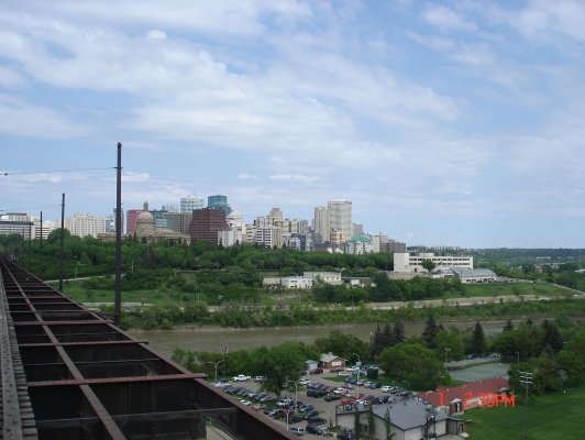
Another Angle for Downtown View
Kinsmen Park
North Saskatchewan River from high level bridge
River Valley Road beside North Saskatchewan River
Legislature Building from high level bridge

The street car will be on its way to Jasper Terminal. And because of that I decided to get out myself of the street car at the station near in Legislature Building for my next tour.

That ended my experience in High Level street car with a quick tour.

Provincial Legislature Building – Edmonton (Part 3)

If someone reading my blog probably noticed that I have a lots of blog for Edmonton. To be honest, if I will not divide it to each topic, my Edmonton City blog might be very long . I wanted to shorten my story as much as possible. Because every time I write my blog. I tend to tell all the details. Because when I am remembering something, there are lots going on in my mind.
Anyway, I have to stop explaining my reason.My next feature is the Provincial Legislature Building. When I am asking some of my colleague at work what are the places that I can visit in Edmonton, they told me the Legislature Building. After I heard it, I searched it in Internet and tried to plan how I will be able to go to this place.I went to this building last June 1 2008, Sunday with an actual tour plan of the following: High Level Bridge tour, Provincial Legislature Building tour and Edmonton Queen River Boat tour. I guess I have a whole busy Sunday that time.
Legislature Building
The Magnificent Fountain

At first, when I arrived at the vicinity of the Legislature Building, I thought I can just get inside and have my own tour since it was free. When I approached one of the guard in the building, he told me that I have to go to the Interpretive Centre and Gift Shop. So I followed his instructions. I found out that the tour guide are waiting for us in that place. I was grouped with other tourist.

Next thing happened, the tourist guide started to give us a building tour outline to give us idea what we are expecting in the tour. From Interpretive Centre we went to the Legislature Building. Then, our guide started talking about all information of the building and some historical information of Canada related to the building. When I saw the first floor of the building I see an awesome fountain in the middle and the Grand Staircase.

Rotunda
Grand Staircase


Wonderful Ceiling

The guide showed us important statues such as Princess Louise Caroline Alberta – fourth daughter of Queen Victoria and Chief Crowfoot. When I heard the name of Princess Louise, I asked the guide if it is the same person of Princess named after famous Lake Louise and the guide agreed. Well, I learned that information from the tourist guide in Banff. I remember that Princess Louise was small lady. And I can see that in her statue in the Legislature Building.

Princess Louise Caroline Alberta

Chief Crowfoot


Next thing that the tourist guide showed us are the portraits of the person who became Alberta’s Premiers (head of the government). As of this writing I cannot remember anymore the names of the Premiers that was mentioned by the guide. Next, portraits that was showed to us are pictures of Alberta’s Lieutenant Governors (representative of the Queen). Then, the guide led us to the Mace Case. We saw two mace. One is the original mace and based from the guide it was made from scrap materials which was amazing. And I learned that the mace is a symbol of Legislative Assembly authority to make laws. The other mace was the current mace being used.

Mace case

Then, the guide led us the Legislative Chamber, but before that, we saw the picture of King George V and Queen Mary. One thing that the tourist guide emphasize in these two portraits of the King and Queen. The guide mentioned to us to look into their eyes and try to walk in either direction and we will see what is it. I followed the instruction of the guide and I found out that it seems that their eyes are following us like they are looking to us. I just realized how great that painting was.

King George V

Queen Mary

After the portraits, we went inside the Legislative Chamber. I was amazed on what I saw. The lightnings of the chamber was fantastic. The main door of the chamber seems to be fully crafted and the same thing with the Speaker’s chair. Inside the chamber, I saw the portrait of Queen Victoria.

Speaker’s Chair

Inside the Legislature Chamber

Last but not the least, I spent few minutes outside the building premises by taking lots of picture of the pool, fountain and the Legislature building itself.

Legislature Building with the pool

Zooming the front structure of Legislature Building

Left side of Legislature Building

The Fountain and Legislature Building


In the end, I had a great time inside and outside the Legislature Building.

Birthday At Banff

For the past years, I celebrated my birthday usually with my family and close friends. Previous celebration was held with simple party. What am I trying to say here? The fact is, my birthday is being celebrated with people. I commonly received birthday greetings and gifts from dear friends. But this year, it was different.

Why I said it was different? First, I am out of the country. It means that those people who used to know my birthday was not with me this time. Second, most of them will not be able to contact me because I never gave my number to them (except to my family, my boss and some colleagues). Third, I never mentioned or probably the right word is “reminded” them that my birthday is almost coming or happening in Canada.

But, even this is the case, I have plans. My birthday will be happening in a different country which is totally a different place from what I used to be, I just thought that I have to celebrate it in an extraordinary way.

I was in Canada that time for training purposes and since I have this eagerness to see some places in this country, I planned to go out and see it. I went to Banff, Alberta (I am not sure who might reading this might say, you wanted to see “Canadian Rockies”). But to be honest, I just have this little idea what will I expected to see in that place. All I am expecting is to see beautiful places that are totally different of what I used to see.

Friday – May 16 (I went to work that day – because I have to), but I went home early because my bus schedule to Banff was 6:30 PM. I rode Greyhound bus (and I am very lucky because the bus station was just near the place where I stayed in Edmonton). Total travel time was five hours and there will be two station where the bus will stop: Red Deer and Calgary.

Since I am traveling to Banff alone and no one was with me and I am not familiar with the place, there was incident that I thought that Red Deer was Calgary. I am not listening to the bus driver when he mentioned that we were in Red Deer. One of the passenger just told me we were at Red Deer. From time to time I have been sleeping during my travel from Edmonton to Calgary. I arrived in Calgary around 10:30 PM. The next bus to Banff was 11:30 PM. The Calgary station was in Calgary downtown, I went outside the bus station and looked around the place. I saw the Calgary Downtown that night. It was pretty much similar with Edmonton Downtown. I never able to capture pictures because I am quite shy to the people passing on me. What I did was I remember as much as I can what Calgary Downtown look like that night.

11:00 PM, I went back to the bus station and waited until 11:30 PM (I am surprised because the bus that will be going to Banff will go to Vancouver too (during that time I wish I can go to Vancouver). Another thing, our bus driver was a woman who was surprising for me.

Few minutes after we left Calgary station, the bus got some technical problems and the driver decided that we need to go back to the station where we came from. It was the best decision she can made, and she told us that her most important responsibility was her passengers safety (which was great but I am kind of bit worried because I am supposed to be at my hotel in Banff at 1 AM – May 17, my birthday), we went back to the station and transferred to another bus.

I arrived at Banff station at 2:30 AM and no one was around. I am thankful that my boss in Canada gave me a mobile phone temporarily. I able to call a cab in Banff and the cab picked me up in the Banff station. I am at the front of hotel where I made my reservation and to my surprise they are telling me to go to another hotel, this made me confused and made me worried because it was almost 3AM in the middle of the morning and I am still outside of hotel in a place which I visited first time in my life and I am alone. I went to Ptarmigann Inn and talked to the hotel clerk, and told them that I had been instructed to go there. The friendly old men accommodated me and explained to me that I will check-in in Ptarmigann because the hotel that I made my reservation was full. I did not object anymore and I am thankful that I can go to my room and rest before my day will start.

3:30 AM, I went to bed and slept for four hours.

I woke up at 7:30 AM and prepared myself. The tourist bus picked me up at the hotel at 9 AM. I met Kevin, the tourist guide. Since I never had my dinner before I went to Banff, I am really hungry and requested Kevin if I can still order my breakfast. He agreed to me and he will be back to me after picking up the other tourist.


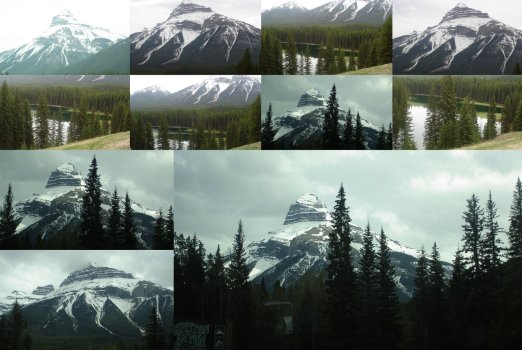
Around 9:30 AM, we were on our way to Banff National Park. First stop Johnston Canyon. I wondered that time, what we were suppose to be doing in a canyon. Kevin told us that we were going to hike in a canyon.


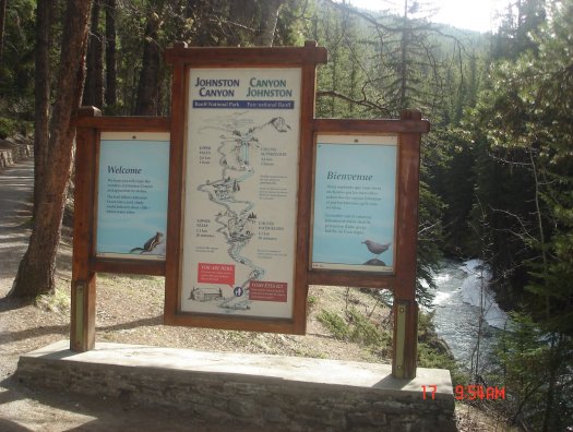
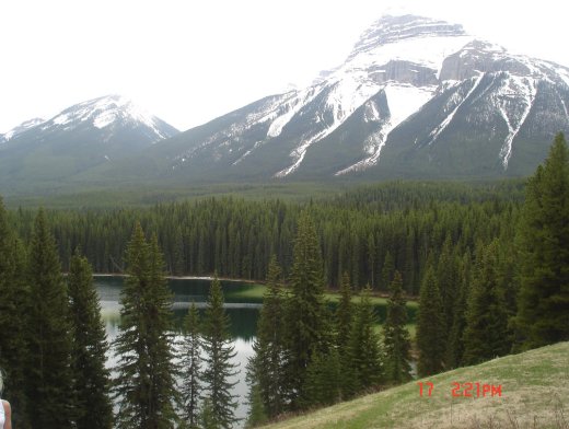
During the hike, I found out that Johnston Canyon has a very amiable trail. And I like Johnston Creek too because there were still ice at the side of the creek. There were three falls that we found while hiking the canyon. They called it the Lower Falls, first falls that we saw, then unnamed falls, but I call it Middle Falls since it’s between Lower and Upper Falls. The last falls was simply the Upper Falls. During the hike, Kevin talked about the Canyon (and I cannot remember it now). I prepared the hiking activities that was why I brought lots of bottled water and because of this my bag was heavy. During the hike I was accidentally fall while trekking the trail with solid ice at the ground and I was glad that not so much people around that time when it happened to me, even Kevin did not notice it. I enjoyed watching the creek and listening to the sounds of the water flowing into the creek. I like the mist of cold weather in the canyon. I also went to the small passage which similar to a cave passage so that I will be able to see up close and personal the Lower Falls. Then, we continued our hike. We saw the unnamed falls and for me its perfect too. Then we walked upward until we found the Upper Falls. The surrounding of Upper Falls were still ice. And I am thinking that this fall is more beautiful during summer season. After taking pictures around that falls, we descended the canyon. We were at the ground again past 12 PM.

Next, we move to Pilot Mountain lookout which just near the canyon since it was along the Bow Valley Parkway. We drove to the place and had a short walk up to the lookout view-point, I was really amazed in the view of Pilot Pond just near the Pilot Mountain ground. It has dark green color at the middle and light green color at the side. Pilot Mountain is one of the mountain that can be easily recognize due to its shape. Its distinct compare with other Mountains in Banff National Park. This was the mountain that I been looking after when we went out the Banff town site while on our way to Johnston Canyon.


After the tour in the morning till afternoon, I went home and had a short rest at the hotel. Then, at night I went for wildlife safari, I am somewhat curious what animals looks like in Canada. First, we went to Mount Norquay (for what I know this mountain is famous for skiing and other winter related activities). We went there hoping we could see some animals around the place. While on our way to the top, we found Mountain Goad Kid and while moving around we found deer. We stop in a lookout view-point in Mount Norquay wherein we can see the whole Banff town site and the valley itself.


Next, we move to the Vermilion Lake hoping we can find some animals and we were lucky to find some birds near in the lake. Even though we never saw a lots of animals, I enjoy looking around the Banff National Park. I saw Mount Rundle and Sulphur Mountain while we were enjoying the awesome view of Vermilion Lake. I really enjoyed all the places we visited, I never regret that I decided to visit Banff during my birthday.

I hope I can comeback in Banff in the future.

Downtown / City Center – Edmonton (Part 2)

Downtown was the place that excites me when I was on my way to my hotel from the first day I arrived in Edmonton. I planned to go out that night after I checked-in to my hotel at Crown Plaza which located in downtown and rested for a few hours.
Edmonton Downtown (mixed photos)

When I heard the word downtown, the impression to me was that this is a place where most of the people go. This means that this is a busy place. I went outside the hotel to walk around the downtown at past 9PM. That night I saw City Centre Mall, Bell Tower and other shopping store. But to my surprise, most of the establishments were closed and I did not expect it. I was surprised because downtown looks dull to me that night and I saw few people around. I cannot stop myself to compare this place to cities we have in Philippines. Weekend made the cities busy too. There are lots of people outside, malls are open until 11 PM. When I was in downtown, I was a little bit shocked. Since mall were closed that time, I had difficulty to find a restaurant that I can have my dinner. I stopped at the front of Bell Tower and decided to take a cab and asked the driver to drive me to the nearest open restaurant. The cab driver brought me to a Chinese restaurant. I was glad because I can eat rice. The driver waited for me and he drove me back to the hotel. First night, was not that pretty much excited but I have a lot of time to enjoy Edmonton.For almost two months of staying in Edmonton, one thing that I can say about downtown is, it is a busy place during weekdays but dull or I can say ghost town during weekend. Weekdays because most of the offices are located here and lots of people are working here.When I met my colleague at work, I had a chance to dine in different restaurants in downtown. The following restaurants are Co co di,Haweli, Sherlock’s Homes and Kids In The Hall Bistro. I had a chance to eat at Courthouse Cafeteria too. There was another place where my colleague used to eat. I can’t remember the name now. It is located in the food court. All I can remember is the name of the owner. They call her Amy. I just like to mention it here because, there is something especial in this eatery. Since it was located in a food court, there are other diner near in Amy’s eatery but to my surprise, most people or I can say all people are falling in line with Amy’s eatery while none will be seen in other diner. Sometimes I pity the other eatery because competition to dining business does not really exist. It is like monopolizing the dining business in that place.Few days passed, some of my colleagues walked me around the Citadel, Canada Place, Sir Winston Churchill Square and City Hall. One thing that I noticed in places in downtown. There are connected ped ways to each building structure. And I learned that its purpose is not to go outside especially during winter season.

Canada Place
Shaw Conference Centre

Magnificent Fountain at the front of City Hall

City Hall

100 St

I was lucky when we visit City Hall, the reason was I met one of the councilor of Edmonton City. But unfortunately I did not bring my camera to have a picture with him.

I admired the city hall because it has a great and distinct structure of the building. It has a pyramid glass ceiling and impressive fountain at the front of the building. I remembered that one time, when I planned to stroll again at the downtown, I witnessed a high school graduation event in city hall.

Most of the prestigious hotel in Edmonton can also be found in downtown like Fairmont Hotel MacDonald, The Westin Edmonton, The Sutton Place Hotel, Crown Plaza Chateau Lacombe (where I stayed during my first five nights in this city), Courtyard by Marriott and a lot more.

Fairmont Hotel MacDonald

The condo unit where I stayed is along 104Th street. One Saturday morning, I was surprised when I went outside, there is a market along 104Th street. And people are coming by. Then, I realized after I checked some of the features of Edmonton downtown guide, that 104Th street is what they call city market. I did look around and found a lot of stuff being offered, plants for gardening, foods and souvenir stuff

Bell Tower at Downtown Edmonton

104 St

Grant MacEwan College

102 Avenue

102 Avenue from The Bay Mall

102 Ave corner 102 st

During my last day tour in Edmonton which happened last June 7, 2008 – Saturday, with my buddy at work. I had a chance to see what is inside the Shaw Conference Centre. During the time we went there, there is ongoing convention and to my surprise Shaw Conference Centre is vast and huge place. And like to add also that I cannot forget that my buddy and I tried to ride the slant elevator just for the experience. Well the ride was cool.

When I was strolling around downtown, I met few Filipinos at the front of City Hall. Unlike me, they are in Edmonton for contract working. They were also new in the city that was why they were also touring the place. Because of them, I had a chance to have some pictures of places in downtown with myself. I was really thankful because I met them.

TELUS Plaza, what can I say in this place? Of course, TELUS Tower is great and I like the open plaza, where you can just sit there and enjoy the beauty of the place. But there is one place that I really like, I don’t know what they call on that part of the plaza, most people do smoke in this place but I like the view, because I can see North Saskatchewan river and the panoramic view of south part of Edmonton. It was a really nice view.

Telus Plaza South (2nd Highest Building in Edmonton)

I also had a chance to see the Little Italy. A place where buildings and houses looks like of course in Italy during my unplanned tour in Edmonton together with some friends I met at the church.

Another experience I had in downtown is watching ball games. How can I forget my first ever ball game that I watched in my entire life. I am not really a sports person but when I found out that David Beckham will be visiting Edmonton and will play football game, I bought a ticket and watched his game. I went to Commonwealth Stadium after the office and I had this experience where the LRT station are full of commuters, this was the first time that I saw a lot of people inside the LRT station, because my previous experience most of the time especially during weekend, not so much people riding the train. These people will watched Beckham games. Based on what I heard while inside the stadium, the people dropped by to watched the game was reaching 35000 and for me that was significant number. During the entire game, people are yelling of Beckham games, especially women. They loved David Beckham.

I can say that I have a lot of things that enjoyed in downtown, lots of places that I had been, and a lot of people who I met. And I think this ends my story at Edmonton Downtown.

Telus World of Science – Edmonton (Part 1)

Maybe the people who read this might say “Are you a kid?”. And one thing that I will respond to is a smile. Telus World of Science is a museum where most of the kids and children go. The word science itself is enough to say that it’s a museum to educate children most of the time but adult like me will also benefit to this kind of place. For me, any museum is fascinating, because I know that I will be learning something or I will be discovering something in this place.

Inside the EPCOR Environment Gallery

I visited Telus World of Science last May 30 2008, Friday. I came from the office, then I went home to the condo unit where I stayed and I took a bus to go there. Since I was never been there before, I used my Edmonton Map (it was actually an ETS – Edmonton Transit System map). I found that there was a mall before the museum – its Westmount Centre. I took a bus from downtown to Westmount station and I rode another bus to Telus World of Science. Well, discovering a way to go to somewhere around Edmonton was one of the exciting experiences I had in this city.Since I visited the place during the weekday, there were few visitors inside the museum. And most of the visitors I saw were children together with their parents. I went to the counter and inquired how I will be able to get a tour inside the museum. The officer explained to me, then, I paid a ticket and one of the crew did a brief orientation. I have a map and it helps me to find myself where I am. First, I went to EPCOR Environment Gallery where I discovered where Edmonton is getting the source of their electricity. Next was Allard Family Gallery where I found the “Body Fantastic”. Then, the next thing I did was watched an IMAX movie “MUMMIES – Secrets of the Pharaohs”. Last but not the least I did was, I went inside the Margaret Zeidler Star Theatre (Canada’s largest planetarium dome theatre) where I experienced a 3D star and laser light shows. I am a frustrated dreamer of being astronaut, and when I was able to see the show, all my dreams of being astronaut are all coming back to me.

Main Entrance
Telus World of Science

Before I leave Telus World of Science premises. I also found observatory with lots of telescopes RASC (Royal Astronomical Society of Canada) Edmonton Centre. And I was lucky because I was able to view one of the star named Acturus using one of the huge telescope and I saw a wonderful star that looks like a planet.

One of the Telescope from Observatory

All I can say was I really had a great time visiting Telus World of Science. If I will have children someday and I will be given a chance to go back in Edmonton, I will definitely bring my kids in this place.

Edmonton – Silent Capital City of Alberta

Two things I will never forget in this city. First, the people I met and second, the places that I was able to visit for a short period of time.

When I informed by my boss in Manila that I will be sending in Edmonton for training there was a part of me that was unhappy. Why? Because I never heard the name of this city. I never knew that this city was existed. I wish I had been assigned to Vancouver or Toronto, because these two cities are well-known to the whole world. But, it was not my wish that should be followed. It was work that was why I was sent in this city.

I arrived in Edmonton City International Airport at past 6PM or almost 7PM last April 26, 2008 and it was Saturday. I never got a chance to walk around the airport. Once I was out of the plane I looked for my luggage and find a cab that will drive me to Crown Plaza hotel where I stayed for my first five nights.

When I got myself out of the airport, I was excited because I was curious what Edmonton looks like. Along the way, I saw some snow at the side of the road which indicates that winter season just recently over. I saw some oil company buildings and structures and I learned from the cab driver that Edmonton has a lot of it. I also noticed that Edmonton is somewhat a flat place, no mountain or even hills. I also thought that the airport is just near in the city center but it’s not. My excitement decreased when I see nothing for a while aside from a flat land. Few minutes passed again, I saw houses and small buildings which was a sign of community. I was more thrilled when I saw buildings and towers which was a sign of being a city.

I knew to myself that one day was not enough to experience this whole city. I took all my time to go around the whole Edmonton which became an interesting place to discover.

Here are the highlights of Edmonton City that I found while staying here for almost two months.

Capilano Suspension Bridge and Park

I just like to create a simple blog about Capilano Suspension Bridge and Park which located in North Vancouver, at the province of British Columbia in Canada. Why I admired this park? I admired this park because I like the look and feel of a forest with a sense of tourist friendly. Why? Basic reasons: abundant tall trees, different kind of plants and of course the cold green color of the forest. And why I said it is tourist friendly? Because it has a friendly trails to trek which I knew built for the tourist.
Capilano Suspension Bridge and Park Collage

Entrance

Friendly Trail

While inside the park I found Totems and the area is called as “Spirit Stage”. Based on Canada history, Totems are important to the First Nation people in Canada.

 
Totems at Spirit Stage

Next to Spirit Stage is the popular suspension bridge (although this is not the original suspension bridge built before). It was renovated for the safety of the travelers like me. My favorite part , jumping while crossing the suspension bridge, the feelings were mixed like jittery, breathless yet exciting. Before I forget to mention, the river under the bridge is the Capilano River.

Capilano Suspension Bridge
 
Capilano River

During my visit I discovered that there are plenty of small and narrow suspension bridges inside the forest, these bridges are connected to one another using trees, they called it “Treetops Adventure”. I enjoyed walking in the Cliffhanger Boardwalk and I liked looking at the flowing river – the view was extraordinary. I also found some small swamps inside the park, these swamps made me remember that I am inside the forest. Not to mention also, I did not miss the Canyon Lookout to glanced the Capilano River in a different angle. Visiting this place was really worth for me since I love forest.

Treetops Adventure

Cliffhanger Boardwalk
Capilano River from Cliffhanger Boardwalk
swamp inside the forest

I like buying souvenir stuff that was why I enjoyed the shopping stores located inside the park and I bought post cards. There are also coffee shops and restaurants inside the park, they kept myself glutted.

I highly recommend to visit the park to anyone who loves nature.

Notes:

1. Plan to visit Capilano Suspension Bridge Park ? Check more details here.

Address :
3735 Capilano Road
North Vancouver, BC
Canada V7R 4J1

Tours : There are lots of tours available that offers the visit in the park and it can be combination with other tourist spot too.

Not on tours? : The park offers free shuttle bus coming from Vancouver Downtown. For more details, please check here.

2. Directions

Using Bus

From Downtown, take bus #246 and get off at Stop#54391 – NORTHBOUND (NB) CAPILANO RD AT WOODS DR.  Then take, bus#236 and get off at Stop#54304 – NORTHBOUND (NB) CAPILANO RD AT 3600 BLOCK.

Using Seabus

Take the Seabus from Waterfront Station, to Lonsdale Quay Station. Then take, bus#236 and get off at Stop#54304 – NORTHBOUND (NB) CAPILANO RD AT 3600 BLOCK.

For more details visit, Translink.

First Blog at Google

A year ago, I wrote some blogs in other website but I stop doing it because I had been busy at work. I started blogging after I met some friends online and inspired me to write my own stuff. I could have many reasons for writing a blog but the most important reason is to share my thoughts to other people, just write whatever goes into my mind. Before, I wrote blog because it felt good to be heard by people who knew me and even the people who had no idea who I am.

I think this will be the same reason I have right now, maybe because I can see that I have more free time right now to do it (I hope I am right on that speculation in the future).

Anyway, whatever goes into my mind and I think that I wanted to write it here, I will write it here.

So, stay tune on my next blog.